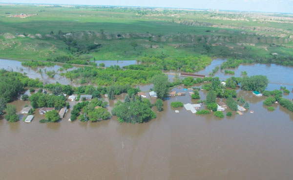
The federal government and the City of Prince Albert are each investing $60,000 in a one-year flood mapping project.
Flood mapping identifies areas that are at risk of flooding. This allows communities to take preventative measures to reduce damage if the area is struck.
Flooding is the costliest and most frequent natural disaster in Canada.
The project began on May 22.
A federal government news release said areas of the city are at risk of flooding from the North Saskatchewan River. There are four different neighbourhoods consisting of over 2,000 properties that lie within a 1:500 floodplain. This means that on the Annual Exceedance Probability (AEP), the area has a one in 500 chance of flooding in any given year.
Minister of Public Safety and Emergency Preparedness, Ralph Goodale, said all levels of government are working on making communities more aware.
“Flood mapping is where it all starts,” he said.
“Get the science done, get the knowledge so we know when you get a year’s worth of precipitation in 48 hours what is going to happen. You’ve already modelled it in advance so you know where that water is going to go.”
20 others receiving federal and provincial support in separate project
The Prince Albert project is one of two flood mapping projects that was announced on Monday.
In the second project, 20 communities across Saskatchewan are receiving both provincial and federal funding. Each level is providing $500,000.
The WSA identified communities including Saskatoon, Regina, Melfort, Tisdale, La Ronge and Foam Lake as at-risk of suffering recurrent flood damage.
Sam Ferris, vice-president of the province’s Water Security Agency (WSA), said the project uses a more modern approach.
A contractor out of Vancouver collected data using a Light Detection and Ranging (LiDAR) system. Now, they’re doing mapping and flow modelling.
“It’s a broader initiative to understand what’s happening on the land and what’s contributing to flooding,” he said.
Once the flood mapping is completed, he said the communities can be careful about building on the at-risk land and build structures that can divert water away from homes.
This project is expected to take one year and began on June 26. The federal government news release said the population of these 20 communities is almost half the total population of Saskatchewan.

