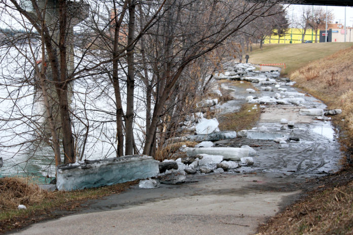
The authors of a new flood mapping study say the City of Prince Albert may want to consider redeveloping the most at-risk parts of the West Flat into recreational areas, nature reserves or wetlands to reduce the impact of flooding.
They also say city council might want to draft a bylaw that gives the City first option to purchase at-risk West Flat properties when they go up or sale. Other options to protect the area from flooding include building a 2.9 km long dyke. Report authors Stantec Engineering estimated the cost would be around $3.5-million, excluding property acquisition.
The solutions are part of a 92-page flood mapping report included in the agenda package for Monday’s city council meeting. The report estimates which Prince Albert properties would be affected by one-in-25 (1:25), one-in-50 (1:50), one-in-75 (1:75), one-in-100 (1:100), one-in-200 (1:200) and one-in-500 (1:500) year flood events. It also looks at possible mitigation measures to reduce the hazards.
The West Flat area is by far the most vulnerable area of Prince Albert. The report estimates 13 properties would be affected by a 1:75 year flood. That number jumps to 27 properties for a 1:100 year flood, 46 properties for a 1:200 year flood, and 378 properties for a 1:500 year flood. The estimated maximum depth of a 1:100 year flood would be roughly 1.25 metres.
“It is recommended that the City bylaw be finalized to provide governance around reducing impacts to development in flood areas,” the report reads. “Specific types of development such as parks and trails may be exceptions to this development guideline.
“The City may consider implementing a bylaw to allow the City to have the first option to purchase properties in the flood plain when they go up for sale. In this way, over time, the City could remove properties at risk of flooding and redevelop flood plain areas into recreational areas, nature reserves or wetlands.”
In his own report to city council, Prince Albert’s planning and development director Craig Guidinger wrote that an earth berm and water-filled barriers could be used to provide flood protection for both the West Flat and East Flat at a reduced cost.
Guidinger also wrote that protecting properties on both sides of the North Saskatchewan River still requires further study, along with regulatory approvals.
The East Flat is the second most vulnerable area of the city. Stantec estimates that 1:100 year floodwaters would not hurt the area, but seven properties and one building would be affected by a 1:200 year flood. That number jumps to 1,139 properties for a 1:500 year flood (estimated maximum depth of 2.15 metres).
The Hazeldell area is the third most vulnerable part of Prince Albert. Stantec estimates a 1:200 year flood would affect 18 properties. That number jumps to 82 properties for a 1:500 year flood (estimated maximum depth of 2.35 meters).
Stantec says development or property acquisition bylaws used to protect the West Flat could also help those two areas. The City could also construct a roughly 2.2 km long dyke near the East Flat, at an estimated cost of $2.8-million, or a 1.55 km long dyke near Hazeldell at an estimated cost of $2-million. Neither estimation includes the cost of property acquisition.
Stantec says the City could also use development or property acquisition bylaws to protect the East Flat from flooding.
Despite including proposals that include dykes and other flood barriers for the North Saskatchewan River (referred to as the NSR in the report) Stantec advised council to do more research before building one.
“The impacts of protecting properties on both the north and south sides of the NSR (West Flat, East Flat and Hazeldell areas) at the same time would require further investigation into the effects of any dykes or berm systems on the modelled flood evaluations,” the report reads. “Regulatory approvals would be required for this type of construction and the impacts of encroaching on the floodplain and reducing conveyance (possibly increasing flood elevations) would need to be examined in detail.”
The Stantec Flood Mapping Study assessed flood hazards along roughly 16 km of the North Saskatchewan River, plus roughly 6.5 km of the Little Red River. The last flood mapping study conducted in 1984 showed more than 2,400 residential properties would be impacted by a 1:500 year flood event. Stantec’s study shows 1,599 properties would be affected.
The study also included options for protecting Prince Albert’s Water Treatment Plant (WTP) and Waste Water Treatment Plant (WWTP).
Prince Albert has experienced high-water flood marks in 1915, 1974, 1980 and 2013, which were used in Stantec’s estimations. The 1915 flood is considered to be a 1:200 year flood event. That year, waters from the North Saskatchewan River reached 8.5 metres above normal levels. The City also flooded in 1875 due to ice jams.
The Flood Mapping Study is one of seven reports from administration and committees up for debate at Monday’s executive committee meeting. They also have a three-item consent agenda. All decisions made at executive committee meetings still need to be approved at a regular council meeting.
All COVID-19 restrictions are still in effect.

